About All Tours Hiking ToursPrivate ToursTrekking ToursFrom Marrakech ToursAnd Sahara Desert Tours Directions Hours & Fees
Find Tours 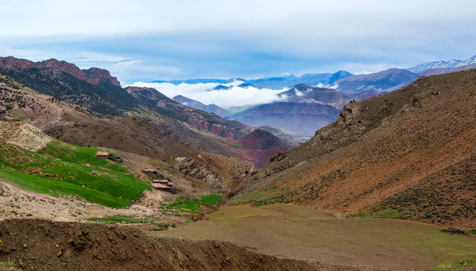
The Atlas Mountains form a 2,500-kilometer natural wall across Northwest Africa, dividing the Mediterranean coast from the Sahara Desert. Mount Toubkal anchors the range in central Morocco, rising 4,167 meters above sea level to claim the title of North Africa's highest peak.
Massive tectonic plates collided millions of years ago to push 2,500 kilometers of rock into the sky across Morocco, Algeria, and Tunisia. The Atlas Mountains act as a physical barricade. They stop the Sahara Desert from swallowing the Mediterranean and Atlantic coastlines. Six distinct subranges make up the system, including the High Atlas, Middle Atlas, and Anti-Atlas. Mount Toubkal dominates the central Moroccan skyline, rising 4,167 meters above sea level to claim the title of North Africa's highest peak.
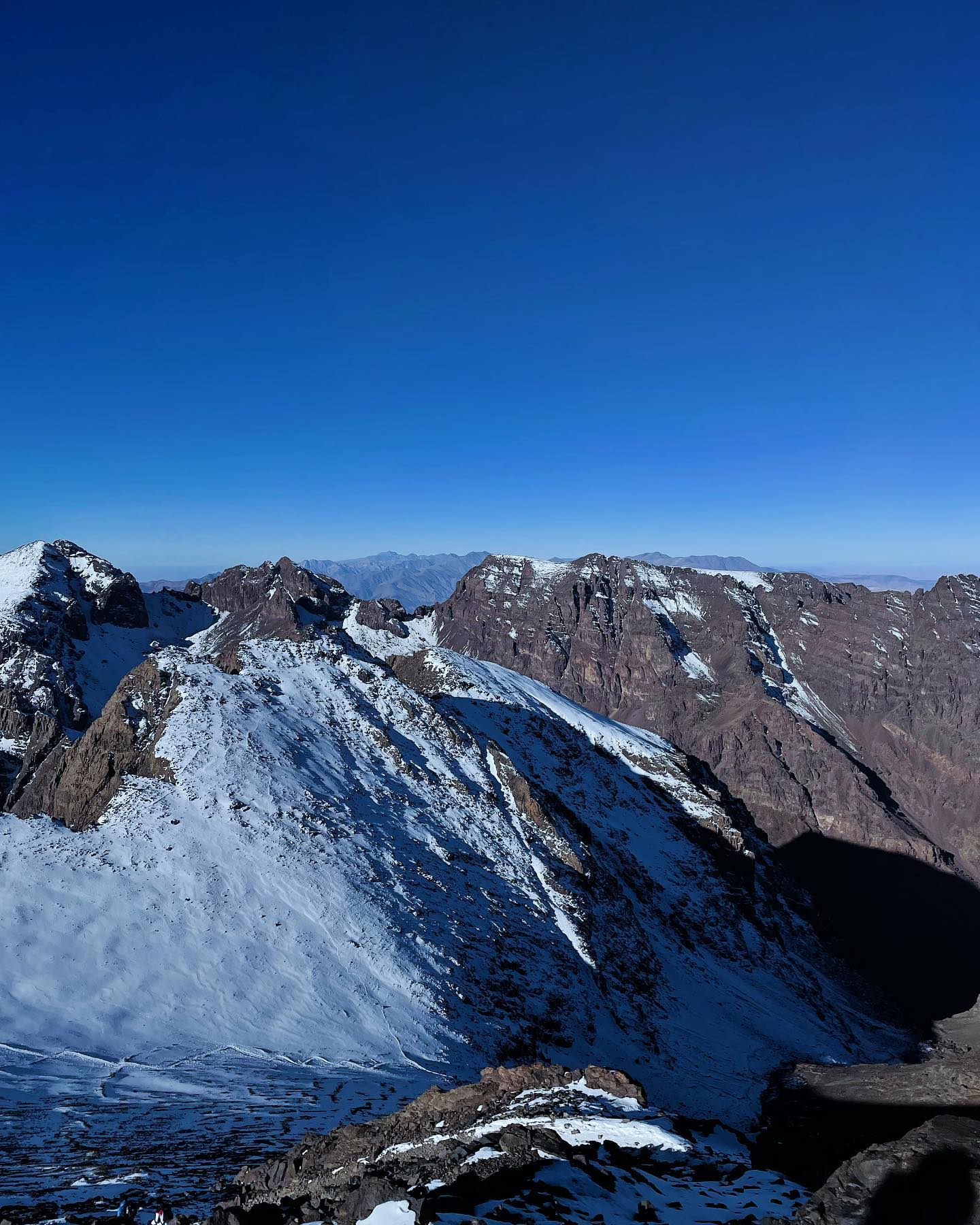
Snow caps the highest elevations from November to April. Below the snowline, terraced green valleys cut through red clay earth. Rivers carve deep gorges into limestone cliffs. Visitors walk through walnut groves in the Ourika Valley, passing seven cascading waterfalls along an 8-kilometer trail. Barbary macaques watch from the riverbanks. The air thins noticeably above the 1,740-meter town of Imlil. Shared grand taxis make the 64-kilometer drive from Marrakech to Imlil in 90 minutes, charging 50 to 70 MAD per person. Trekkers rent crampons and walking poles here before pushing up to the Neltner refuge at 3,200 meters. The final summit push begins at 4:00 AM to catch the sunrise over the Sahara.
Altitude sickness hits many climbers around the 2,800-meter mark, bringing nausea and sharp headaches. Summer temperatures in the lower valleys exceed a dangerous 50°C by July. Winter snow blocks high passes like the 2,260-meter Tizi n'Tichka entirely. Smart climbers target May through October for clear trails. Basic guided treks cost €50 per day, covering permits, refuge beds, and meals. Premium packages reach €100 per day for private cooks and mule handlers. Bring small Moroccan Dirham notes to buy mint tea at riverside cafes. There is no general entrance fee for the mountains, but local attractions like the Ourika falls charge €2 for access. Fresh water lakes and streams in the region may carry schistosomiasis, a parasitic infection. Rely on bottled water provided by reputable shops.
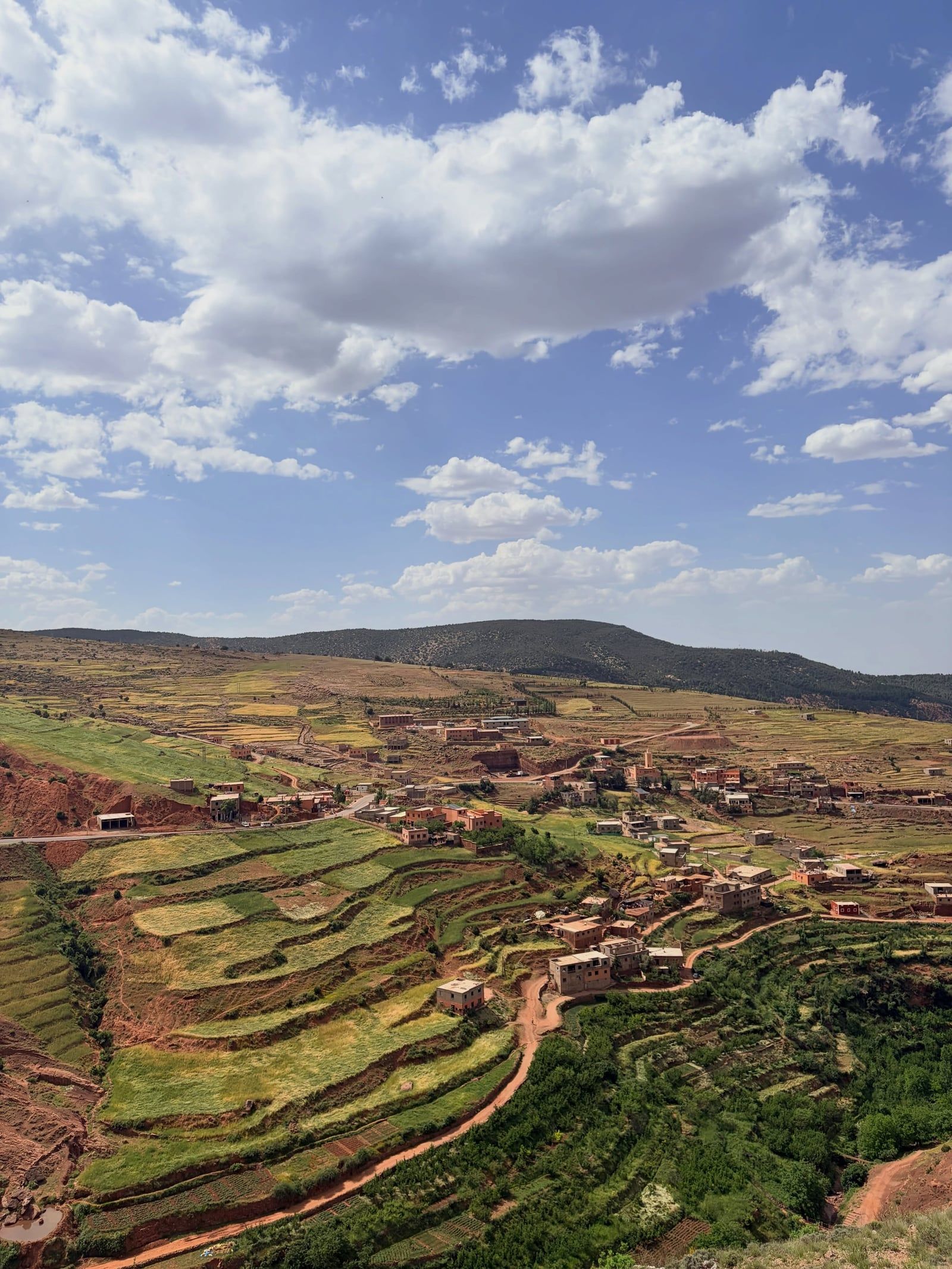
Tectonic collisions during the Jurassic Period fractured Pangea and pushed the African plate into the Eurasian plate, forcing the ocean floor upward. This geological violence created the limestone and basalt peaks visible today. Human settlement dates back tens of thousands of years. Ancient rock engravings scattered across the high plateaus show hunters chasing long-extinct game like elephants and rhinoceroses. The indigenous Berber, or Amazigh, people settled these valleys early in human history. They built mud-brick villages into the cliff sides. They terraced the steep slopes to grow barley and graze sheep.
Phoenician traders arrived on the North African coast in the 12th century BCE, establishing trade routes that reached into the foothills. Roman legions followed in the 1st century BCE, claiming the northern plains for the Empire. The mountains stopped the Roman advance. The rugged terrain provided an impenetrable fortress for the Berber tribes, who launched frequent raids against Roman outposts. Arab armies brought Islam to North Africa in the 7th century. The religion took root, but the mountain tribes maintained their political independence. Two major Berber dynasties emerged directly from these high valleys. The Almoravids swept out of the mountains in the 11th century to conquer Morocco and southern Spain. The Almohads followed in the 12th century, building an empire that stretched across North Africa. They constructed the Tin Mal Mosque deep in the High Atlas. This structure remains one of the few active mosques non-Muslims can enter today.
French forces occupied Morocco in 1912. The Atlas Mountains became a brutal battleground. Berber tribes fought a guerrilla war against the French military for decades, using their intimate knowledge of the caves and passes to ambush patrols. The harsh winters defeated colonial supply lines. Full pacification of the mountains did not occur until 1933. Today, the region relies heavily on agriculture and tourism. The UNESCO World Heritage site of Aït Benhaddou preserves the pre-Saharan earthen clay architecture from this era. Unlicensed guides often approach tourists in Imlil. Hiring a certified local guide ensures proper weather assessment and emergency support on the high trails. Backcountry camping requires permits, which licensed guides secure before departure.
Six distinct subranges divide the 2,500-kilometer system. The High Atlas holds the most extreme elevations, culminating in Mount Toubkal at 4,167 meters. Jagged basalt towers and deep ravines define this central section. To the north, the Middle Atlas features dense cedar forests and limestone plateaus where temperatures drop low enough to support the Oukaïmeden ski resort. The Anti-Atlas in the south borders the Sahara, presenting a desolate landscape of pink and brown granite worn smooth by wind erosion. The Tell Atlas and Saharan Atlas stretch eastward into Algeria and Tunisia, creating semi-arid steppes that transition into pure desert.
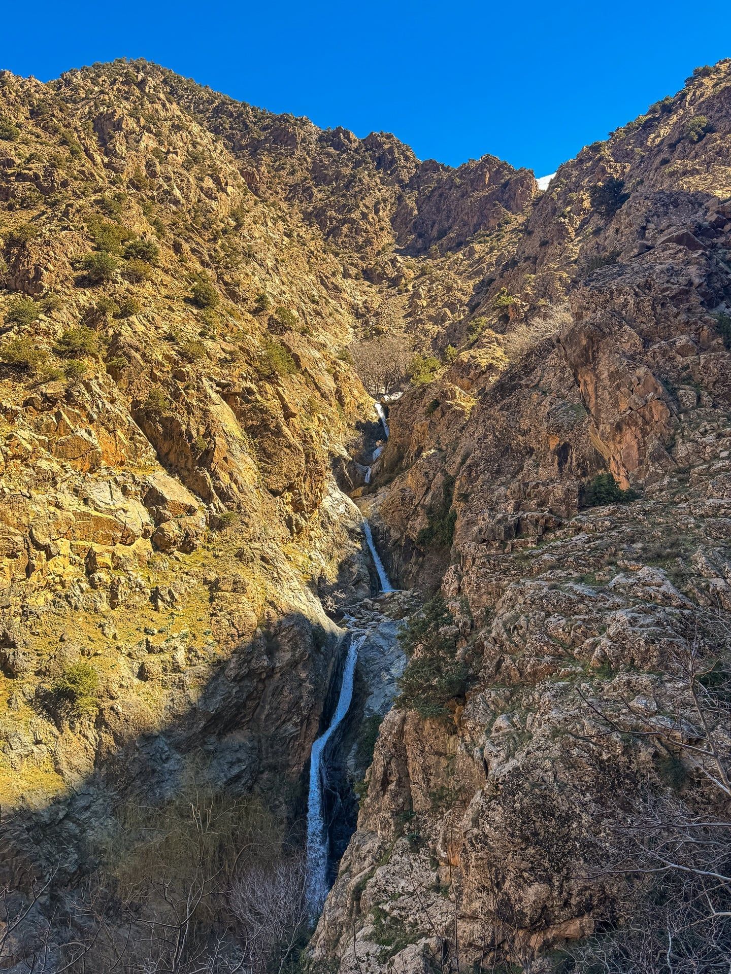
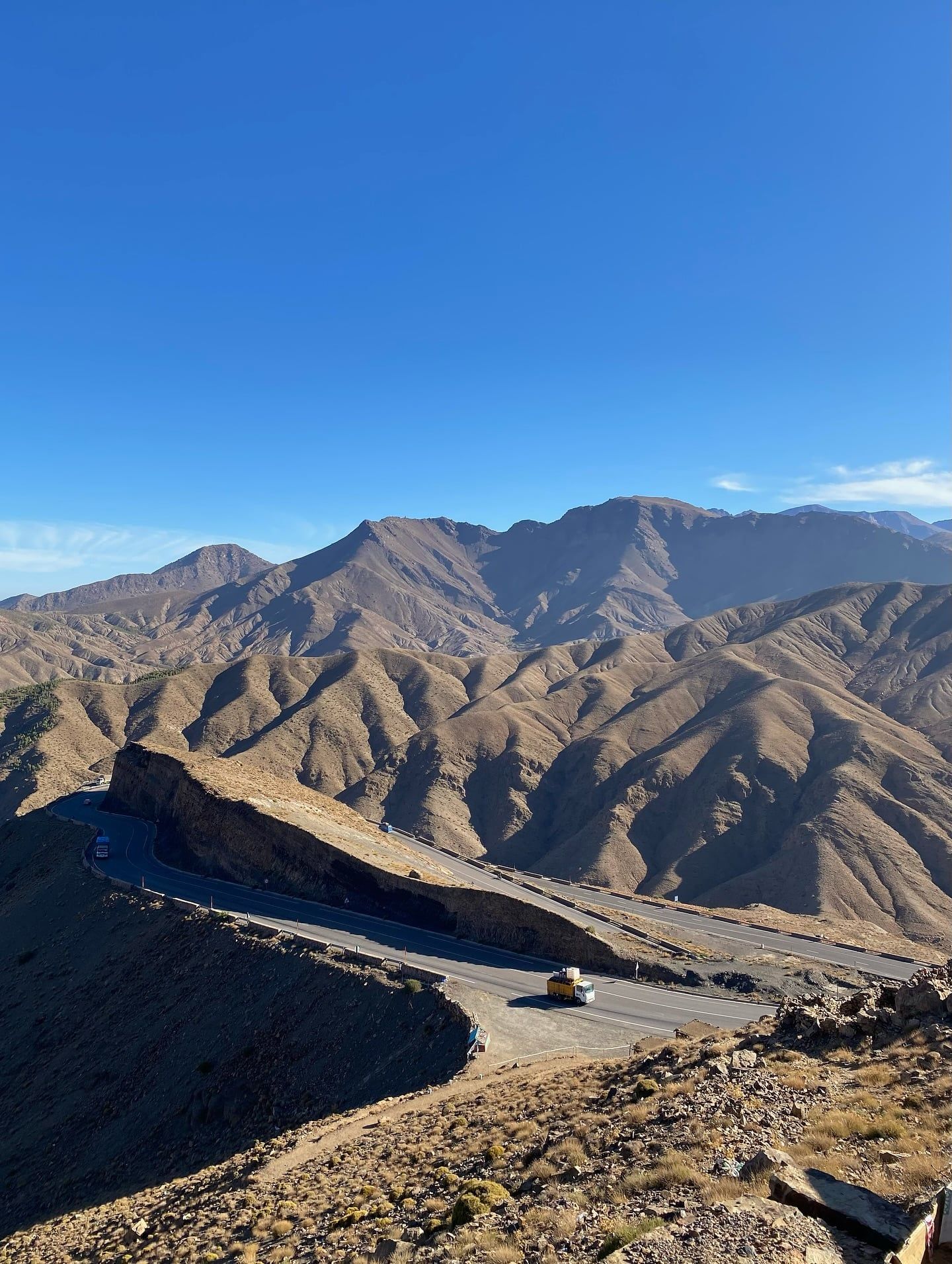
Water shapes the topography. The Todra Gorge cuts a narrow channel through the Central High Atlas. Red limestone cliffs rise 300 meters straight up from the riverbed, while the canyon floor narrows to just 10 meters wide in some sections. Climbers scale these sheer walls at dawn to catch the morning light. In the Dadès Valley, wind and water carved the red rock into bulbous pillars known as the "Monkey Fingers." In the Ourika Valley, snowmelt feeds the Setti Fatma waterfalls. The spray hits hikers 20 meters before they reach the main pools. The Tizi n'Tichka pass winds through the rock at 2,260 meters, linking Marrakech to Ouarzazate. The asphalt clings to the edge of vertical drops, offering clear views of the terraced valleys below.
Flash floods destroy roads and bridges without warning during heavy spring rains. The clay-heavy soil absorbs little water, turning dry riverbeds into raging torrents in minutes. Check the official weather reports in Marrakech before driving the mountain passes. The terrain is highly uneven and rocky. Standard wheelchairs cannot navigate the steep, unpaved paths. Specialized operators like Morocco Accessible Travel Consultants provide adapted 4x4 vehicles with portable lifters. They use Joelette mountain chairs with porters to transport visitors with limited mobility. Pack a windproof shell and thermal layers. Temperatures at the 3,200-meter Neltner refuge drop below freezing even in mid-summer.
The Amazigh people call themselves the "free people." They have inhabited these valleys since prehistoric times, adapting their entire way of life to the vertical environment. Flat-roofed houses made of packed red earth and straw blend directly into the mountainsides. This earthen architecture regulates temperature, keeping interiors cool during 40°C summer days and trapping heat during freezing winter nights. Villages operate on a system of communal labor, sharing water rights for the terraced irrigation channels that keep the walnut and apple orchards alive. The fortified granaries, known as agadirs, sit at the highest point of many villages to protect the community's food supply from historical raids.
Weekly souks anchor the social calendar. The town of Asni transforms every Saturday. Farmers walk miles down steep dirt paths to trade sheep, saffron, and hand-woven wool rugs. These markets function as the primary news network for isolated communities. Local blacksmiths repair tools while merchants sell massive clay tagine pots. Tourists should avoid buying these large pots, as they are highly bulky to transport and do not fit inside conventional European ovens. Food cooks slowly over charcoal fires, filling the valley air with the smell of cumin, turmeric, and roasting lamb.
Modest dress is mandatory in these rural spaces. Visitors must wear long trousers and cover their shoulders. Pointing a camera at a local vendor without asking permission violates basic etiquette and will cause immediate offense. Photography of military installations, police stations, and royal palaces is strictly prohibited by law. Drones require prior registration with the Moroccan Civil Aviation Authority. Carry small Dirham notes to purchase goods directly from the artisans. Stray dogs roam many of the villages. Rabies is present in Morocco, so visitors must avoid petting or feeding any street animals. Seek immediate medical attention for rabies prophylaxis if bitten or scratched.
Skiing happens in Africa at the Oukaïmeden resort, located 80 km from Marrakech.
The mud-brick village of Aït Benhaddou was a filming location for Gladiator and Game of Thrones.
Non-Muslims can enter the historic Tin Mal Mosque, a rare exception in Morocco.
Wild Barbary macaques live along the riverbanks of the 8-kilometer Ourika Valley trail.
Fresh mountain lakes may carry schistosomiasis, making untreated swimming dangerous.
Flying a drone requires explicit permission from the Moroccan Civil Aviation Authority.
Specialized operators use Joelette mountain chairs to help wheelchair users trek the rugged paths.
Mount Toubkal holds the record at 4,167 meters (13,671 feet). It sits in central Morocco and is the primary target for international trekkers.
The system stretches approximately 2,500 kilometers (1,600 miles). It crosses through Morocco, Algeria, and Tunisia.
Basic trekking services start at €50 per day. This covers a licensed guide, refuge lodging, and meals. Premium packages with private cooks and transfers cost €100 or more per day.
Yes. Companies like Morocco Accessible Travel Consultants provide adapted 4x4 vehicles and portable lifters. They use specialized Joelette mountain chairs with porters to navigate the rocky trails.
May through October offers the safest conditions for high-altitude routes. Winter months bring heavy snow and freezing temperatures that block the high passes.
The Ourika Valley features the famous Setti Fatma Waterfalls. Visitors walk an 8-kilometer trail to see seven distinct cascades.
Shared grand taxis depart from Marrakech when full and cost 50 to 70 MAD per person. The 64-kilometer drive takes about 90 minutes.
The Berber people, who call themselves the Amazigh, are the indigenous inhabitants. They have maintained traditional farming and pastoral customs in these valleys for thousands of years.
The Moroccan Civil Aviation Authority strictly regulates all drones. Flying an unregistered drone will result in confiscation and potential fines.
Acute Mountain Sickness often affects climbers starting around 2,800 meters. Symptoms include nausea and headaches, requiring immediate communication with your guide.
Browse verified tours with free cancellation and instant confirmation.
Find Tours